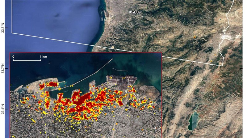

Data from the European Space Agency's Copernicus Sentinel satellites was used to produce the map
On the map, the most severely damaged areas are shown in red and areas moderately damaged are orange. Each colored pixel represents an area of 33 yards, according to NASA.
The Aug. 4 explosion in Beirut's port sent a shock wave that killed at least 160 people, wounded nearly 6,000 and defaced the coastline of the capital city - destroying hundreds of buildings.
The explosion has been linked to a 2,750-ton stockpile of ammonium nitrate that had been stored in a hangar at the Beirut port since it was confiscated from a ship in 2013. The cargo is believed to have detonated after a fire broke out nearby.