

Move over, Google Earth, a new interactive map lets you see where your hometown was millions of years ago.
Whether it’s flicking through random destinations across the globe or spying on wherever your mates come from on Street View, everybody has procrastinated by exploring the world.
However, a new website has upped the ante. Forget looking at your past homes via satellite imagery, now you can see how your hometown moved alongside the evolution of Earth.
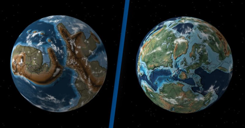
Californian palaeontologist Ian Webster launched Ancient Earth Globe a few years ago. Using a combination of palaeogeographic maps and data from GPlates, a geoscience data resource, the 3D map lets you go back as far as 750 million years in the planet’s history.
The 30-year-old : ‘It shows that our environment is dynamic and can change. The history of Earth is longer than we can conceive, and the current arrangement of plate tectonics and continents is an accident of time. It will be very different in the future, and Earth may outlast us all.’
He added: ‘My software geocodes the user’s location and then uses models to run their location backwards in time. I built the interactive globe visualisation and the geocoding and GPlates integration myself so that people could plug in their own locations.’
Over the course of Earth’s history, super-continents have broken and formed. For example, you can use the map to see where New York City would have been on Pangaea, before it split apart.
Webster continued: ‘It also contains fun surprises, for example how the US used to be split by a shallow sea, the Appalachians used to be very tall mountains comparable to the Himalayas, and that Florida used to be submerged.’
Take the Ancient Earth Globe for a spin here.


.webp)
